Back تينيان Arabic Tinian AST Тыніян Byelorussian Тиниан Bulgarian Tinian Island CEB Tini'an CH Tinian Czech Tinian German Τίνιαν Greek Tiniano Esperanto
This article needs additional citations for verification. (November 2019) |
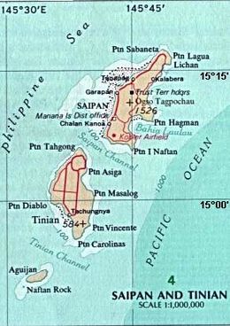
 Tinian on an area map, southwest of Saipan, showing waters around islands, and deeper Pacific section. | |
 | |
| Geography | |
|---|---|
| Location | Pacific Ocean |
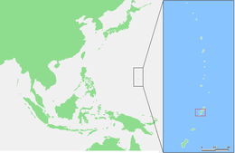
| Coordinates | 15°00′N 145°38′E / 15.000°N 145.633°E |
| Archipelago | Marianas |
| Area | 101.22 km2 (39.08 sq mi)[1] |
| Highest elevation | 187 m (614 ft) |
| Highest point | Mount Kastiyu |
| Administration | |
United States | |
| Commonwealth | Northern Mariana Islands |
| Largest settlement | San Jose |
| Demographics | |
| Population | 2044[2] (2020) |
 | |
Tinian (/ˈtɪniən, ˌtiːniˈɑːn/) is one of the three principal islands of the Commonwealth of the Northern Mariana Islands (CNMI). Together with uninhabited neighboring Aguiguan, it forms Tinian Municipality, one of the four constituent municipalities of the Northern Marianas. Tinian's largest village is San Jose. Tinian is just south of the most inhabited island Saipan, but north of the populated Rota to the south. The island is home to many WW2 historical sites, cattle ranches, and beaches. There was a 5-star casino that operated from 1998 to 2015; remaining are other hotels/resorts and a golf course. The main access to Saipan is by a short airplane ride from the international airport, or by a charter boat.
Tinian is a part of the United States, and is also a part of the CNMI. Along with Guam, they are the westernmost islands of the US in the Pacific (technically very far east).
- ^ "7 TINIAN" (PDF). National Oceanic and Atmospheric Administration. p. 2. Archived (PDF) from the original on November 15, 2020. Retrieved November 15, 2020.
- ^ "Table 2. 2020 Census Population of Commonwealth of the Northern Mariana Islands" (PDF). census.gov. US Census Bureau. Retrieved February 22, 2024.
© MMXXIII Rich X Search. We shall prevail. All rights reserved. Rich X Search
